
MAKE your data make sense
TSS take raw recorded data and process to formats for easy visualisation. Processing stages include:
Photogrammetry
Point cloud to 3D Mesh
360 Panorama Stitching
Geolocate media and metadata
The recorded data can be rapidly integrated with a plan, layout, geoTIFF image or map and made available for immediate presentation. GPS metadata makes positioning an automated process. Completed projects can be shared directly to free Windows software or via any web server.

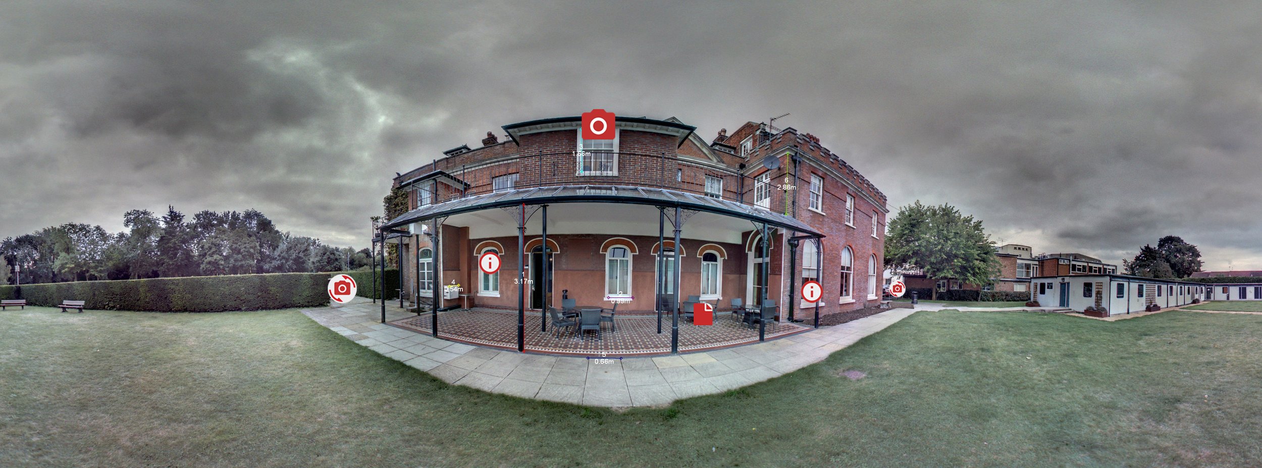
media geolocation
We use specialist project software to integrate the recorded media onto a map, layout or plan for interactive visualisation. Add route markers, tags and icons to allow the user to intuitively explore the area and build up an awareness of assets, risks and routes. Supported media include:
Drone stills and video
MP4 Video
Web Links
JPEG and PNG images
360 Video
360 Stills
Audio clips
Documents
GeoTIFF plans
3d Model creation
TSS process LIDAR pointcloud data and apply photogrammetry to pre-captured imagery to generate full 3D models.
Created pointclouds and meshes use standard formats to export to almost all CAD, BIM and 3D software including Unity and Unreal Engine.
Models can be used for measurement and mapping or exported as an orthomosaic ‘map’ for use with a variety of platforms including Google Maps and Spherevision Project.

Share and Archive
All the formats we export can be stored locally and viewed with free software to future-proof your data.
Securely store and share projects and metadata in SphereVision Project software.